


710-Voting District, Clay County, Florida
About
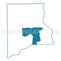
Outline

Summary
| Unique Area Identifier | 552482 |
| Name | 710-Voting District |
| County | Clay County |
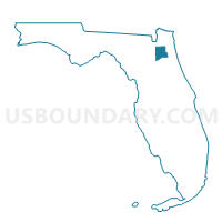
| State | Florida |
| Area (square miles) | 67.28 |
| Land Area (square miles) | 67.24 |
| Water Area (square miles) | 0.04 |
| % of Land Area | 99.94 |
| % of Water Area | 0.06 |
| Latitude of the Internal Point | 29.93575570 |
| Longtitude of the Internal Point | -81.79881760 |
Maps

Graphs
Select a template below for downloading or customizing gragh for 710-Voting District, Clay County, Florida


Neighbors
Neighoring Voting District (by Name) Neighboring Voting District on the Map
- 104-Voting District, Clay County, FL
- 32-Voting District, Putnam County, FL
- 35-Voting District, Putnam County, FL
- 506-Voting District, Clay County, FL
- 508-Voting District, Clay County, FL
- 600-Voting District, Clay County, FL
- 601-Voting District, Clay County, FL
- 606-Voting District, Clay County, FL
- 606GCS-Voting District (Green Cove Springs Municipal), Clay County, FL
- 608GCS-Voting District (Green Cove Springs Municipal), Clay County, FL
- 612-Voting District, Clay County, FL
- 700-Voting District, Clay County, FL
- 708-Voting District, Clay County, FL
- 710PF-Voting District (Penney Farms Municipal), Clay County, FL
Top 10 Neighboring County Subdivision (by Population) Neighboring County Subdivision on the Map
- Interlachen-Florahome CCD, Putnam County, FL (25,540)
- Palatka CCD, Putnam County, FL (23,786)
- Keystone Heights CCD, Clay County, FL (17,852)
- Green Cove Springs CCD, Clay County, FL (14,318)
- Penney Farms CCD, Clay County, FL (14,285)
Top 10 Neighboring Place (by Population) Neighboring Place on the Map
Top 10 Neighboring Unified School District (by Population) Neighboring Unified School District on the Map
Top 10 Neighboring State Legislative District Lower Chamber (by Population) Neighboring State Legislative District Lower Chamber on the Map
Top 10 Neighboring State Legislative District Upper Chamber (by Population) Neighboring State Legislative District Upper Chamber on the Map
Top 10 Neighboring 111th Congressional District (by Population) Neighboring 111th Congressional District on the Map
Top 10 Neighboring Census Tract (by Population) Neighboring Census Tract on the Map
- Census Tract 312, Clay County, FL (14,285)
- Census Tract 313, Clay County, FL (5,756)
- Census Tract 314, Clay County, FL (5,311)
- Census Tract 9501, Putnam County, FL (4,176)
- Census Tract 9502.02, Putnam County, FL (3,599)
- Census Tract 311.01, Clay County, FL (3,269)
- Census Tract 315, Clay County, FL (3,251)
- Census Tract 311.05, Clay County, FL (2,158)
- Census Tract 311.07, Clay County, FL (354)